Program that shows all the details of the given IP address. Build with Python and ipinfo.io API

Overview

ip-details

This is a program that shows all the details of the given IP address. Build with Python and ipinfo.io API

Usage

To use this program, run the main Batch or Shell file, entering an IPv4 address as argument.

$ ip 1.1.1.1

You can also add the --save or -s flag, to save the output to a file. The file will be named details.log, and will be stored inside the saves directory of the program (saves/details.log).

$ ip 1.1.1.1 --save

Or, if prefered:

$ ip 1.1.1.1 -s

Example

$ ip 1.1.1.1

IP : 1.1.1.1
CITY : Miami
REGION : Florida
COUNTRY : US
LOC : 25.7867,-80.1800
ORG : AS13335 Cloudflare, Inc.
POSTAL : 33132
TIMEZONE : America/New_York
MAP : https://maps.google.com/maps/search/25.7867,-80.1800

And with the save option:

$ ip 1.1.1.1 --save

IP : 1.1.1.1
CITY : Miami
REGION : Florida
COUNTRY : US
LOC : 25.7867,-80.1800
ORG : AS13335 Cloudflare, Inc.
POSTAL : 33132
TIMEZONE : America/New_York
MAP : https://maps.google.com/maps/search/25.7867,-80.1800

Data saved to saves/details.log
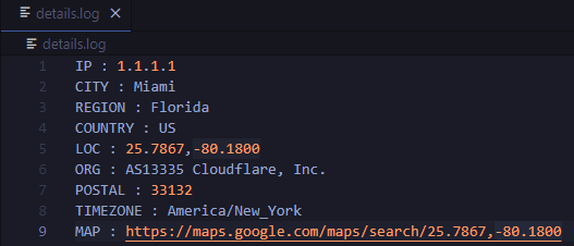
details.log file:

image

Requirements

Python programming language

Requests python library (pip install requests)

A Python package for delineating nested surface depressions from digital elevation data.

Welcome to the lidar package lidar is Python package for delineating the nested hierarchy of surface depressions in digital elevation models (DEMs). I

Qiusheng Wu 166 Jan 03, 2023
Enable geospatial data mining through Google Earth Engine in Grasshopper 3D, via its most recent Hops component.

AALU_Geo Mining This repository is produced for a masterclass at the Architectural Association Landscape Urbanism programme. Requirements Rhinoceros (

4 Nov 16, 2022
Geodata extensions for Django REST Framework

Django-Spillway Django and Django REST Framework integration of raster and feature based geodata. Spillway builds on the immensely marvelous Django RE

Brian Galey 62 Jan 04, 2023
Tile Map Service and OGC Tiles API for QGIS Server

Tiles API Add tiles API to QGIS Server Tiles Map Service API OGC Tiles API Tile Map Service API - TMS The TMS API provides these URLs: /tms/? to get i

3Liz 6 Dec 01, 2021
GeoNode is an open source platform that facilitates the creation, sharing, and collaborative use of geospatial data.

Table of Contents What is GeoNode? Try out GeoNode Install Learn GeoNode Development Contributing Roadmap Showcase Most useful links Licensing What is

GeoNode Development Team 1.2k Dec 26, 2022
🌐 Local tile server for viewing geospatial raster files with ipyleaflet or folium

🌐 Local Tile Server for Geospatial Rasters Need to visualize a rather large (gigabytes) raster you have locally? This is for you. A Flask application

Bane Sullivan 192 Jan 04, 2023
A utility to search, download and process Landsat 8 satellite imagery

Landsat-util Landsat-util is a command line utility that makes it easy to search, download, and process Landsat imagery. Docs For full documentation v

Development Seed 681 Dec 07, 2022
3D extension built off of shapely to make working with geospatial/trajectory data easier in python.

PyGeoShape 3D extension to shapely and pyproj to make working with geospatial/trajectory data easier in python. Getting Started Installation pip The e

Marc Brittain 5 Dec 27, 2022
This is a simple python code to get IP address and its location using python

IP address & Location finder @DEV/ED : Pavan Ananth Sharma Dependencies: ip2geotools Note: use pip install ip2geotools to install this in your termin

Pavan Ananth Sharma 2 Jul 05, 2022
Python project to generate Kerala's distrcit level panchayath map.

Kerala-Panchayath-Maps Python project to generate Kerala's distrcit level panchayath map. As of now, geojson files of Kollam and Kozhikode are added t

Athul R T 2 Jan 10, 2022
Specification for storing geospatial vector data (point, line, polygon) in Parquet

GeoParquet About This repository defines how to store geospatial vector data (point, lines, polygons) in Apache Parquet, a popular columnar storage fo

Open Geospatial Consortium 449 Dec 27, 2022
A simple python script that, given a location and a date, uses the Nasa Earth API to show a photo taken by the Landsat 8 satellite. The script must be executed on the command-line.

What does it do? Given a location and a date, it uses the Nasa Earth API to show a photo taken by the Landsat 8 satellite. The script must be executed

Caio 42 Nov 26, 2022
Evaluation of file formats in the context of geo-referenced 3D geometries.

Geo-referenced Geometry File Formats Classic geometry file formats as .obj, .off, .ply, .stl or .dae do not support the utilization of coordinate syst

Advanced Information Systems and Technology 11 Mar 02, 2022
Starlite-tile38 - Showcase using Tile38 via pyle38 in a Starlite application

Starlite-Tile38 Showcase using Tile38 via pyle38 in a Starlite application. Repo

Ben 8 Aug 07, 2022
A simple reverse geocoder that resolves a location to a country

Reverse Geocoder This repository holds a small web service that performs reverse geocoding to determine whether a user specified location is within th

4 Dec 25, 2021
Pandas Network Analysis: fast accessibility metrics and shortest paths, using contraction hierarchies :world_map:

Pandana Pandana is a Python library for network analysis that uses contraction hierarchies to calculate super-fast travel accessibility metrics and sh

Urban Data Science Toolkit 321 Jan 05, 2023
Color correction plugin for rasterio

rio-color A rasterio plugin for applying basic color-oriented image operations to geospatial rasters. Goals No heavy dependencies: rio-color is purpos

Mapbox 111 Nov 15, 2022
Implementation of Trajectory classes and functions built on top of GeoPandas

MovingPandas MovingPandas implements a Trajectory class and corresponding methods based on GeoPandas. Visit movingpandas.org for details! You can run

Anita Graser 897 Jan 01, 2023
Map Ookla server locations as a Kernel Density Estimation (KDE) geographic map plot.

Ookla Server KDE Plotting This notebook was created to map Ookla server locations as a Kernel Density Estimation (KDE) geographic map plot. Currently,

Jonathan Lo 1 Feb 12, 2022
A GUI widget for Linux to show current time in different timezones.

A GUI widget to show current time in different timezones (under development). To use this widget: Run scripts/startup.py Select a country. A list of t

B.Jothin kumar 11 Nov 10, 2022