Using Global fishing watch's data to build a machine learning model that can identify illegal fishing and poaching activities through satellite and geo-location data.

Overview

Catching-Illegal-Fishing

Using Global fishing watch's data to build a machine learning model that can identify illegal fishing and poaching activities through satellite and geo-location data.

Global fishing watch is a partnership between Google and Oceana to map all trackable fishing activity in world, in almost real time. This is a personal project using the data provided by global fishing watch.

The data provided has vessel ids, types and coordinates of encountered vessels.

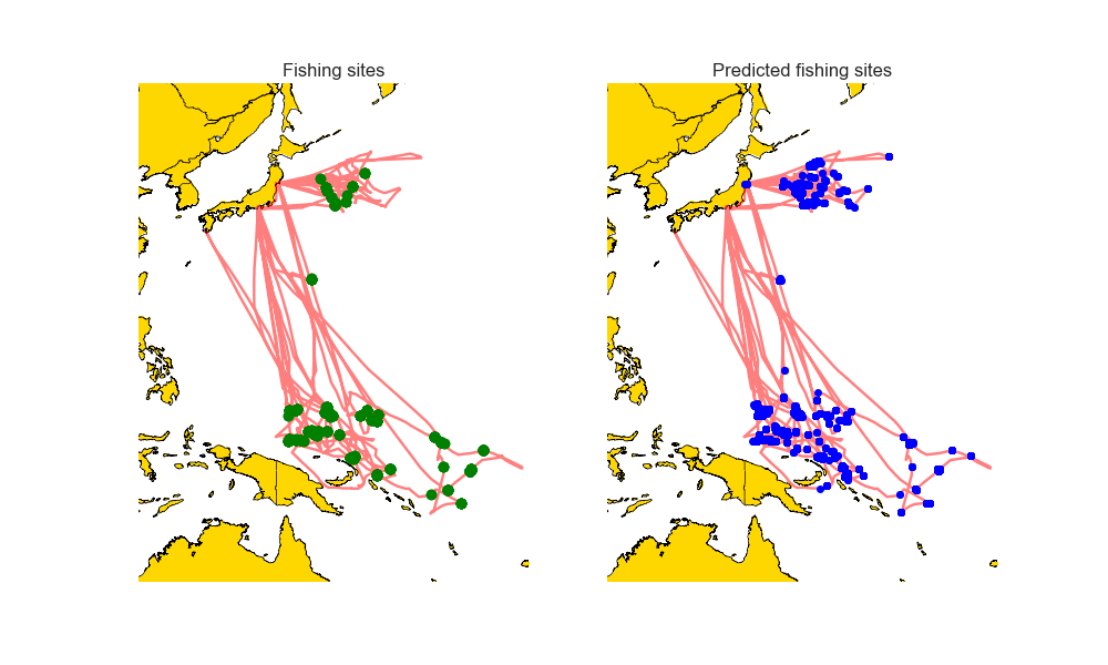
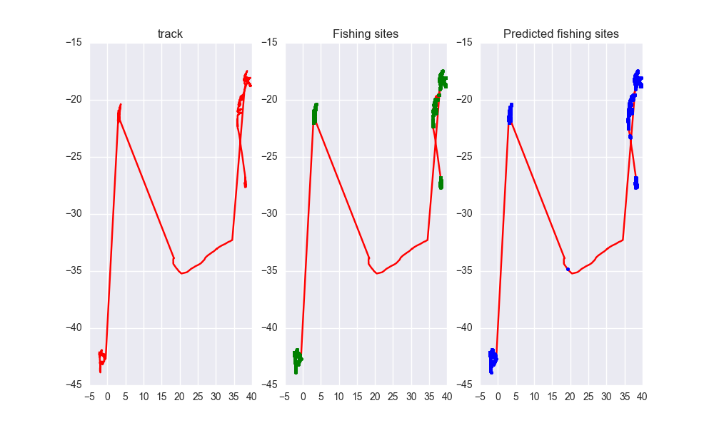
Given same vessel type and are, a fishing vessel has a different trajectory than a non fishing vessel. I used the data provided to train my model on predicting whether a vessel is fishing or not.

#Local Environment Setup Python 3.7++ Tensorflow version >1.14.0,<2.0 from (https://www.tensorflow.org/get_started/os_setup) pip install google-api-python-client pyyaml pytz newlinejson python-dateutil yattag

#Model Result image

image

image

image

image

image

As you can see the predicted tracks are extremely close to the real paths.
Owner
Ayush Mishra
Machine Learning enthusiast.
Ayush Mishra
Minimum Bounding Box of Geospatial data

BBOX Problem definition: The spatial data users often are required to obtain the coordinates of the minimum bounding box of vector and raster data in

Ali Khosravi Kazazi 1 Sep 08, 2022
A simple python script that, given a location and a date, uses the Nasa Earth API to show a photo taken by the Landsat 8 satellite. The script must be executed on the command-line.

What does it do? Given a location and a date, it uses the Nasa Earth API to show a photo taken by the Landsat 8 satellite. The script must be executed

Caio 42 Nov 26, 2022
iNaturalist observations along hiking trails

This tool reads the route of a hike and generates a table of iNaturalist observations along the trails. It also shows the observations and the route of the hike on a map. Moreover, it saves waypoints

7 Nov 11, 2022
This program analizes films database with adresses, and creates a folium map with closest films to the coordinates

Films-map-project UCU CS lab 1.2, 1st year This program analizes films database with adresses, and creates a folium map with closest films to the coor

Artem Moskovets 1 Feb 09, 2022
Ingest and query genomic intervals from multiple BED files

Ingest and query genomic intervals from multiple BED files.

4 May 29, 2021
Hapi is a Python library for building Conceptual Distributed Model using HBV96 lumped model & Muskingum routing method

Current build status All platforms: Current release info Name Downloads Version Platforms Hapi - Hydrological library for Python Hapi is an open-sourc

Mostafa Farrag 15 Dec 26, 2022
WhiteboxTools Python Frontend

whitebox-python Important Note This repository is related to the WhiteboxTools Python Frontend only. You can report issues to this repo if you have pr

Qiusheng Wu 304 Dec 15, 2022
A compilation of several single-beam bathymetry surveys of the Caribbean

Caribbean - Single-beam bathymetry This dataset is a compilation of several single-beam bathymetry surveys of the Caribbean ocean displaying a wide ra

Fatiando a Terra Datasets 0 Jan 20, 2022
Google maps for Jupyter notebooks

gmaps gmaps is a plugin for including interactive Google maps in the IPython Notebook. Let's plot a heatmap of taxi pickups in San Francisco: import g

Pascal Bugnion 747 Dec 19, 2022
Implemented a Google Maps prototype that provides the shortest route in terms of distance

Implemented a Google Maps prototype that provides the shortest route in terms of distance, the fastest route, the route with the fewest turns, and a scenic route that avoids roads when provided a sou

1 Dec 26, 2021
Client library for interfacing with USGS datasets

USGS API USGS is a python module for interfacing with the US Geological Survey's API. It provides submodules to interact with various endpoints, and c

Amit Kapadia 104 Dec 30, 2022
Example of animated maps in matplotlib + geopandas using entire time series of congressional district maps from UCLA archive. rendered, interactive version below

Example of animated maps in matplotlib + geopandas using entire time series of congressional district maps from UCLA archive. rendered, interactive version below

Apoorva Lal 5 May 18, 2022
Expose a GDAL file as a HTTP accessible on-the-fly COG

cogserver Expose any GDAL recognized raster file as a HTTP accessible on-the-fly COG (Cloud Optimized GeoTIFF) The on-the-fly COG file is not material

Even Rouault 73 Aug 04, 2022
Histogram matching plugin for rasterio

rio-hist Histogram matching plugin for rasterio. Provides a CLI and python module for adjusting colors based on histogram matching in a variety of col

Mapbox 75 Sep 23, 2022
Implementation of Trajectory classes and functions built on top of GeoPandas

MovingPandas MovingPandas implements a Trajectory class and corresponding methods based on GeoPandas. Visit movingpandas.org for details! You can run

Anita Graser 897 Jan 01, 2023
Interactive Maps with Geopandas

Create Interactive maps 🗺️ with your geodataframe Geopatra extends geopandas for interactive mapping and attempts to wrap the goodness of amazing map

sangarshanan 46 Aug 16, 2022
OSMnx: Python for street networks. Retrieve, model, analyze, and visualize street networks and other spatial data from OpenStreetMap.

OSMnx OSMnx is a Python package that lets you download geospatial data from OpenStreetMap and model, project, visualize, and analyze real-world street

Geoff Boeing 4k Jan 08, 2023
Download and process satellite imagery in Python using Sentinel Hub services.

Description The sentinelhub Python package allows users to make OGC (WMS and WCS) web requests to download and process satellite images within your Py

Sentinel Hub 659 Dec 23, 2022
framework for large-scale SAR satellite data processing

pyroSAR A Python Framework for Large-Scale SAR Satellite Data Processing The pyroSAR package aims at providing a complete solution for the scalable or

John Truckenbrodt 389 Dec 21, 2022
Creates 3D geometries from 2D vector graphics, for use in geodynamic models

geomIO - creating 3D geometries from 2D input This is the Julia and Python version of geomIO, a free open source software to generate 3D volumes and s

3 Feb 01, 2022