![]()
| Project: | QLUSTER |
|---|---|
| Github: | https://github.com/sammmlow/QLUSTER |
| Documents: | https://example.com/ |
| Version: | 0.1 (Unstable) |
| Author: | Samuel Y. W. Low |
|---|
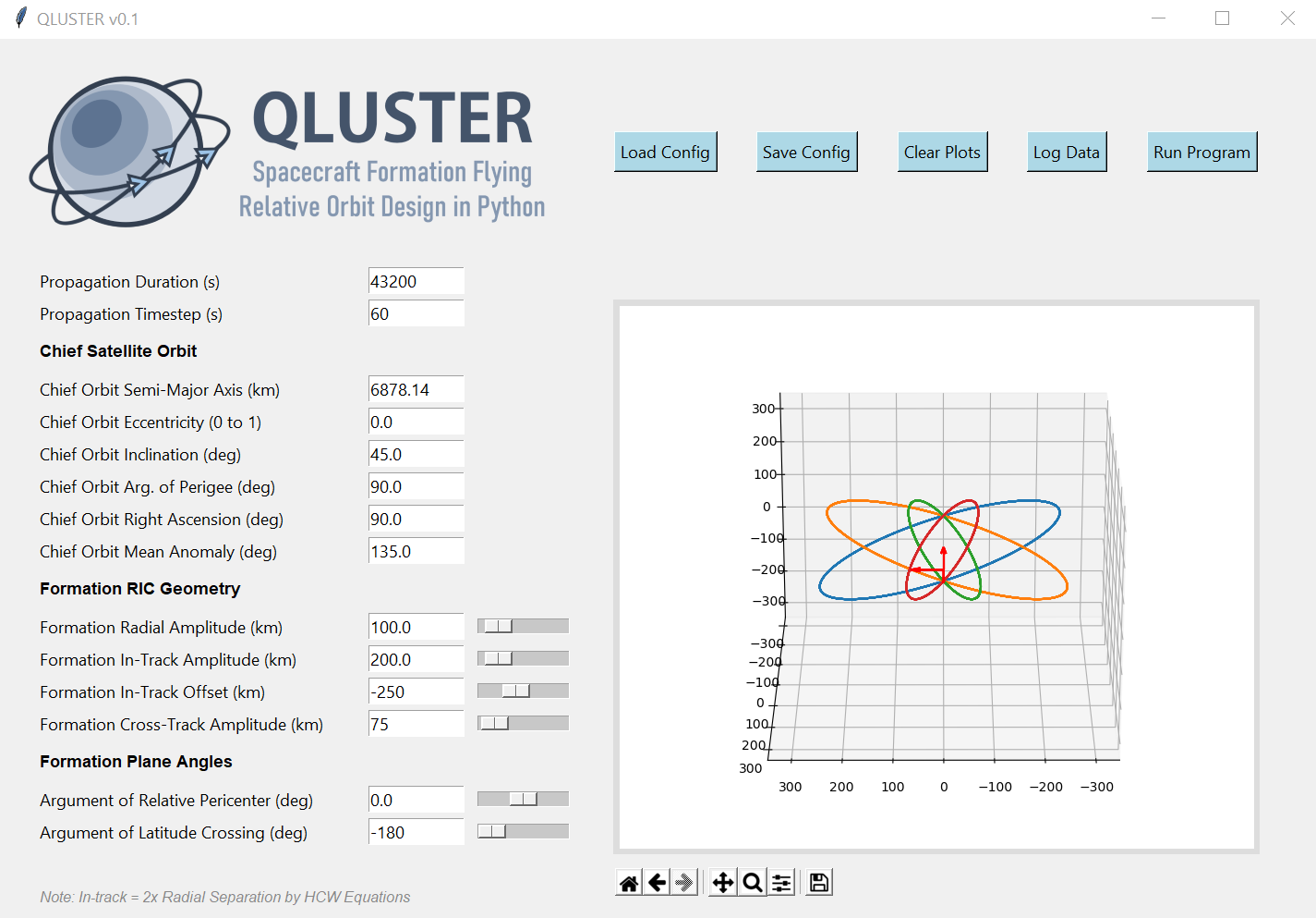
QLUSTER
QLUSTER is a relative orbit design tool for formation flying satellite missions and space rendezvous scenarios, that I wrote in Python 3 for my own research and visualisation. It is currently unfinished (95%) but the core algorithm and app works. Here's an example snippet of the GUI where four deputy satellites are orbiting a single chief in LEO.
I am open-sourcing it, as I would love to collaborate with you to improve on QLUSTER if you have any cool features to add-on in relation to the design, visualisation, and propagation of the relative astrodynamics!
To-Do List: Documentation, deputy orbit determination, logging of ephemeris etc.
Stretch-Goals: Relative orbit propagation for perturbed orbits, and computation of formation maintenance.
Installation and First Steps
First, clone this repository by running in your terminal (or Git Bash):
git clone https://github.com/sammmlow/QLUSTER.git
Then, just run the main qluster.py file in the main directory, and the GUI should pop up. Have fun!
Other Package Dependencies
To be written
Contact
If you have any queries feel free to reach out to me at:
Last Modified on 30-May-2021

 2 Jan 10, 2022
 57 Nov 01, 2022
 79 Nov 26, 2022
 1 Nov 18, 2021
 83 Aug 19, 2022
 304 Dec 15, 2022
 192 Jan 04, 2023
 1 Feb 12, 2022
 4 Nov 16, 2022
 224 Dec 30, 2022
 50 Dec 15, 2022
 142 Dec 30, 2022
 70 Nov 18, 2022
 1.1k Dec 18, 2022
 419 Dec 30, 2022
 651 Dec 16, 2022
 67 Dec 23, 2022
 2.1k Dec 29, 2022
 342 Dec 31, 2022